|
| ||||
| The Dolores dilemma SideStory: Mountainfilm comes to Dolores
by Missy Votel
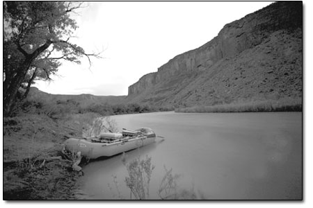
“The spring wind and weather has been eating it up,” said Vern Harrell, Bureau of Reclamation liaison for the Dolores River Project, of the region’s snowpack. “This year we don’t even know if we’ll fill the reservoir.” The reservoir, which was a capacity of 229,000 acre-feet is expected to receive 225,000 acre-feet of runoff this spring. With the latest prediction, this would make for a 10-day spill of about 800 cfs in order to stretch the flows out as long as possible. However, when and if this happens is anybody’s educated guess. While the BuRec ideally shoots for Memorial Day Weekend, sudden temperature or precipitation spikes could influence it either way. “We’ll know more the week after the reservoir starts to fill, depending on weather and storm forecasts,” said Harrell. He said flows will most likely not be significant enough for commercial rafting companies to plan trips, but savvy local boaters at the ready could luck out with some careful monitoring of the BuRec’s web site at www.doloreswater.com. “That’s the best information out there,” said Harrell of the site, which is updated twice a week. In targeting Memorial Day Weekend, May 28-30, the spill will be held back until May 20, if possible. However, in 2009 McPhee filled early pushing up the release start date to May 11. Last year, cold weather caused the reservoir to fill slowly, holding back the spill until May 24. Despite the ambiguity of the current situation, an effort is under way to lend more predictability to the river’s flows, which typically bottom out at 50 cfs in summer and 30 cfs in the winter. A steering committee for the Dolores River Dialogue, a varied group of user interests which has been meeting since 2004, will be revealing two proposals to benefit the Dolores’ downstream fisheries next week. The flow from McPhee was originally conceived with the nonnative, cold-water trout sport fishery in mind, but the objective has since grown to include the warm-water fishery of native species such as suckers, chubs and pike minnows. There is also concern over the health of the river’s riparian zone as well as the geomorphology of the riverbed, including sediment build up and flow.
The steering committee’s first proposal looks at the use of “selective level outlet works,” which would basically allow water to be pulled from various elevations within the reservoir for release. “In the past, we have only pulled water from the bottom, because that’s the coldest water for the trout, but we can get better water quality for the native fish with warmer water higher up,” Harrell said. The second proposal from the group calls for the Montezuma Irrigation Co. to lease 6,000 acre feet of water from the Colorado Water Conservation Board for downstream flows. The water would actually come from Groundhog Reservoir, north of Dolores, and flow through McPhee, which is overallocated as is. The lease would be for any three years out of a 10-year span, although the sequence of those three years remains to be seen. “We will have to develop that concept, but details still aren’t here yet,” Harrell said. While the latest proposals mark progress in reaching a balance between habitat, recreation and water rights on the river, work on permanently protecting what is considered one of the West’s classic and pristine canyon landscapes is farther out. Recommended for status under the Wild and Scenic Rivers Act in 1976, the Dolores River Canyon has since faced threats not only from dewatering but resource extraction, grazing and invasive species. However, the prospect of wilderness designation did not sit well with all the river’s constituents. As a result, the Lower Dolores Working Group formed out of the Dolores River Dialogue in 2008 as a means of reaching an agreeable solution to protect the corridor from McPhee to its confluence with the San Miguel River near Gateway. Much of the land surrounding the river is managed by the Bureau of Land Management, and a good portion of that land is designated wilderness study areas. “While there is a lot of desire to see the Dolores River protected, there is also a lot of concern over wilderness designation,” said Amber Kelley, Dolores River Campaign Coordinator for the San Juan Citizens Alliance. Since bringing those disparate voices to the table three years ago, a consensus has been reached to designate the river and its surrounding environs as a National Conservation Area versus outright wilderness. However, work on forwarding legislation stalled when a consensus could not be reached on water flows. As a result, “The Way Forward” was pitched as a blueprint around the stalemate. “There was a lack of agreement, so we decided to hire three independent scientists to look at the status of native fish to help us work through the doable flows,” said Kelley. The scientists are expected to wrap up work this July. Using the scientific data and the local community’s input, Kelley said the group will again try to move forward within the river’s existing constraints. “The hope is, after this process, we will wrap back around and draft legislation,” she said.
|
In this week's issue...
- December 18, 2025
- Let it snow
Although ski areas across the West have taken a hit, there’s still hope
- December 18, 2025
- Look, but don't take
Lessons in pottery theft – and remorse – from SW Colorado
- December 11, 2025
- Big plans
Whole Foods, 270 apartments could be coming to Durango Mall parcel


 As the San Juan snowpack dwindles after another dry, windy spring, so do chances for extended boatable flows on the lower Dolores River. Earlier this week, incoming flows into McPhee Reservoir, which feed the lower Dolores, were forecast to drop by 12 percent from previous estimates.